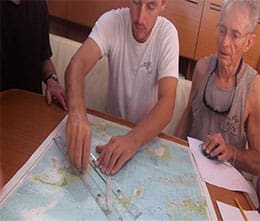
Coastal Navigation is a classroom only navigational theory course that will teach you how to safely navigate a sailing yacht in coastal or inland waters. A combination of traditional techniques and electronic navigation systems will be covered.
It is common today for most sailors to rely on electronic navigational equipment such as a differential GPS or radar. The intent of this course is to expand on these modern systems to teach you how to confidently and safely navigate using a minimum of resources and traditional methods. Upon completion of this course you will have the insight and feel of a seasoned navigator.
Please visit our course and certification information page for more information on pricing. Contact us to check course availability and to schedule your course.
Directions: Getting to Us
NESC recommends that students have completed their Basic Keelboat and Basic Cruising Certifications to ensure familiarity with standard yacht and sailing terminology.
- Certification: ASA 105 Coastal Navigation Certification
This course is offered online in an interactive format with the instructor:
For more information and to register ASA 105 Coastal Navigation certification course:
ASA Registration
Curriculum for this course includes Aids to Navigation, the Mercator chart, understanding use of a navigation log, safe inshore pilotage, weather information integration, navigational strategies, fog safety precautions, variation and deviation, plotting tools, and benefits and limitations of navigation systems.
Able to apply the navigational theory and practices for safe navigation of a sailing vessel in coastal and inland waters. On-water coastal navigation skills elements are contained in the ASA103, Basic Coastal Cruising, ASA 104, Bareboat Cruising, and ASA 106, Advanced Coastal Cruising, in progressively increasing levels of detail.
PRACTICAL SKILLS
Knowledge
- Explain the chart symbols and conventions on U.S. nautical charts in accordance with the terminology of Chart #1
- Identify a source of official U.S. Coast Guard navigation publications
- List the publications required for prudent navigation in the local area
- Describe the instruments required for prudent navigation in the local area
- Describe the purpose and example contents of a “Notice to Mariners”
- Explain the terms and characteristics used for lighted navigation aids
- Explain the significance of shapes, colors, and lights used in the U.S. Aids to Navigation (ATON) system
Skills
- Use the tide and current tables
- Convert courses and bearings between true, magnetic, and compass
- Check compass deviation by a transit bearing or other means
- Plot a dead reckoning position on a chart using speed, time and course to steer
- Allow for the effect of current and leeway to plot the estimated position
- Determine a course to steer which takes into account known current and leeway
- Determine current given the course steered and speed and two observed positions
- Plot a chart position from terrestrial objects
- Chart a course of at least 20 miles and three course changes using the above skills